Product Design Engineer II, Consultant
2019 → 2021
Figma / Sketch / Invision
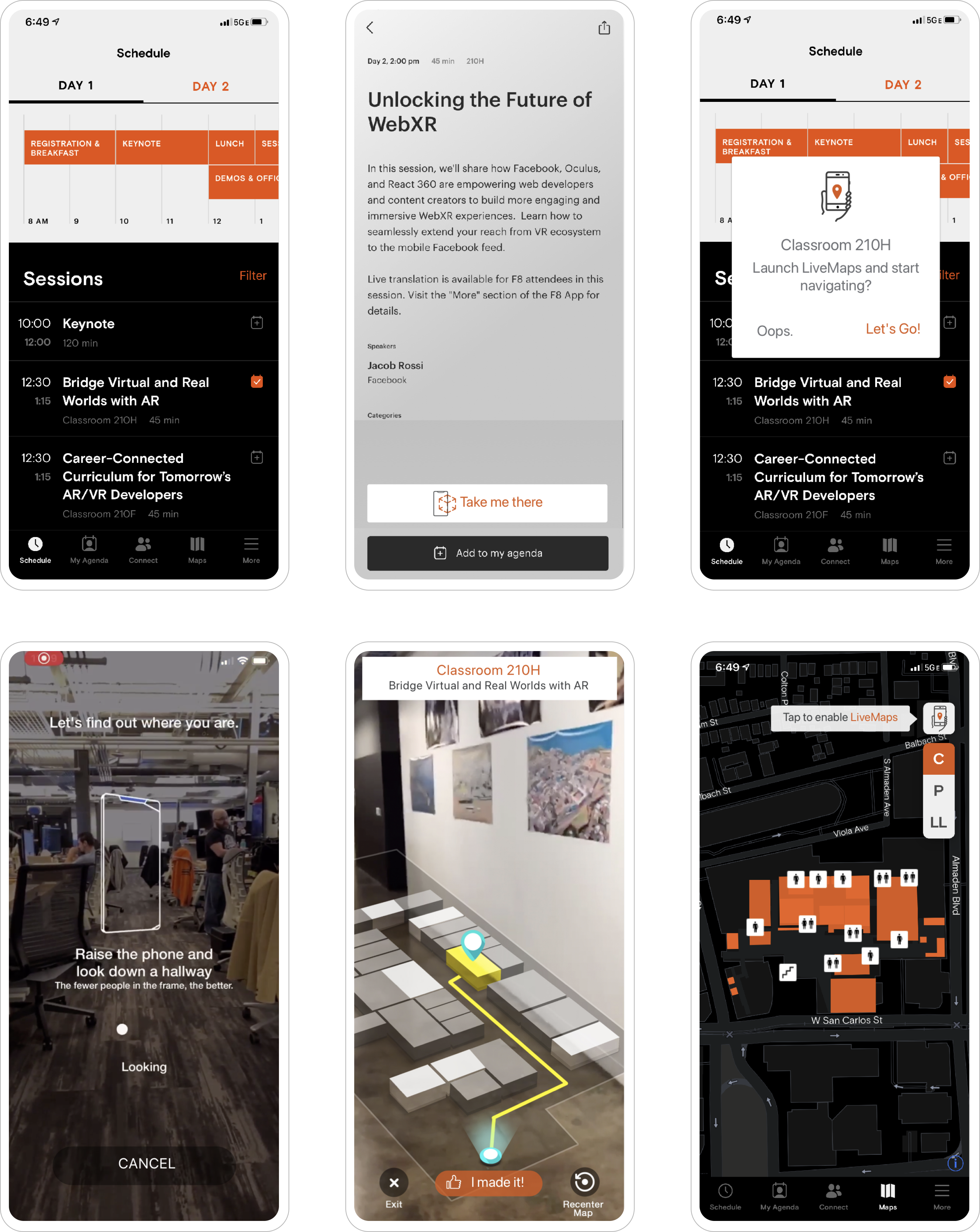
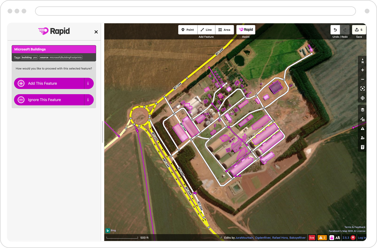
I was hired on a two-year contract to join a new team called World.AI, focused on mapping the globe through a partnership with OpenStreetMap.org. Our work involved analyzing high-definition satellite imagery and using AI to detect map features such as roads, buildings, and street signs. I led the design of a new mapping tool called RapiD, which I named and developed by building on the OpenStreetMap platform, enhanced with AI-generated features from our processing tools. During my time there, I also designed and launched an augmented reality navigation app for the Facebook F8 conference and explored innovative mapping and navigation solutions for wearable devices like smartwatches.
RapiD Mapping
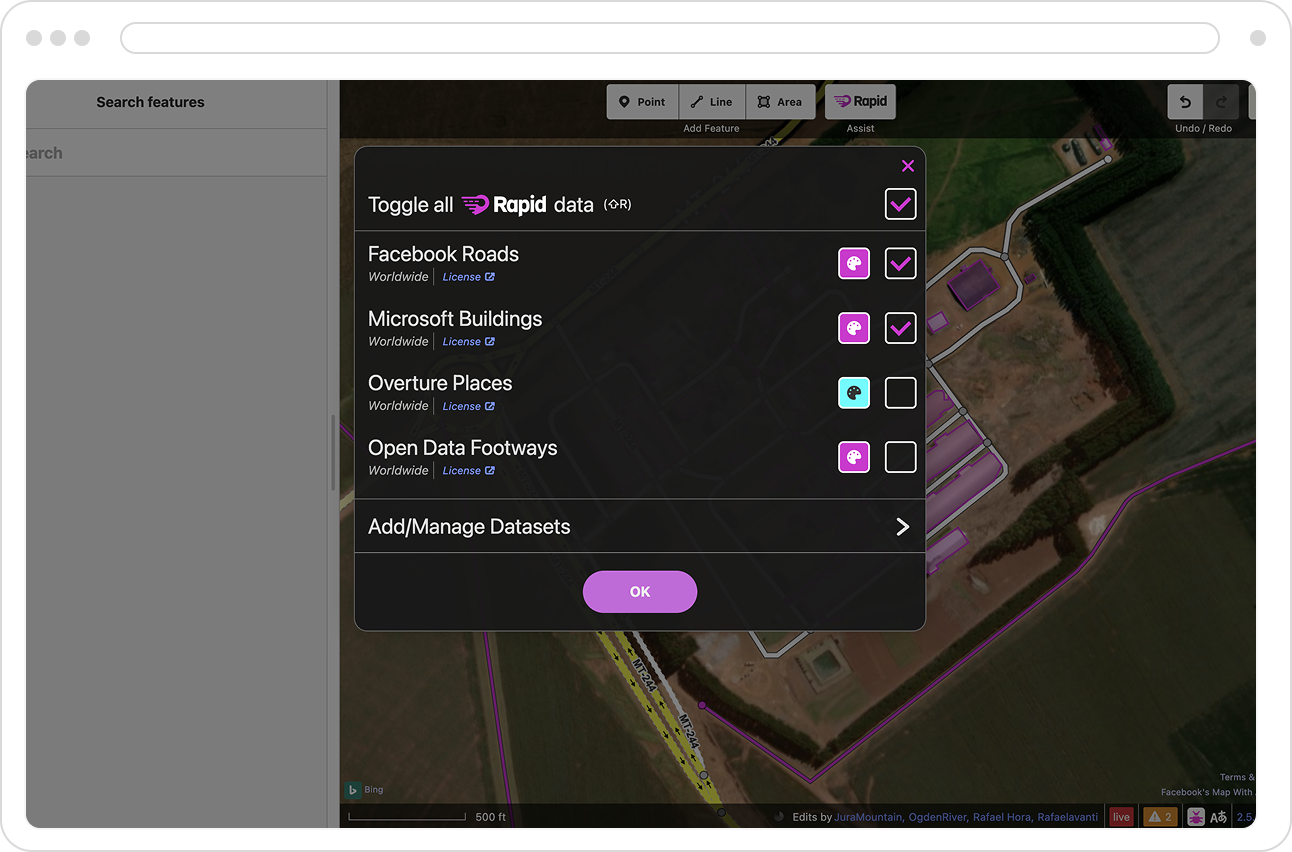
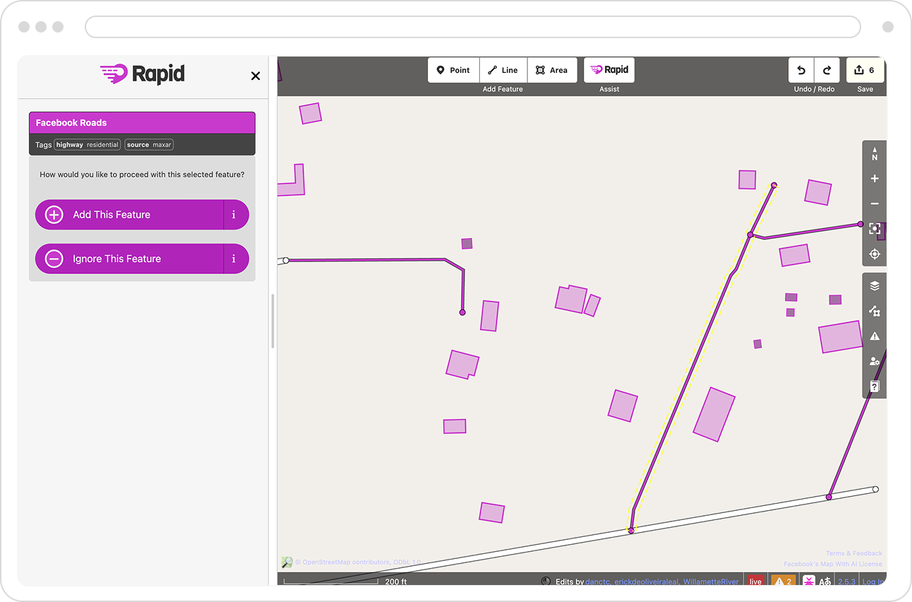
We designed and shipped a beta version for testing in about 9 months. Starting with AI detected roads, we quickly found partnerships in Microsoft (providing AI detected buildings) and Worldwide (various locations and footpaths). Openstreetmap users were now able to toggle on and off any AI detected feature, allowing them a light speed workflow in which they were now able to add to the global map.
Wayfinder Augmented Reality Navigation
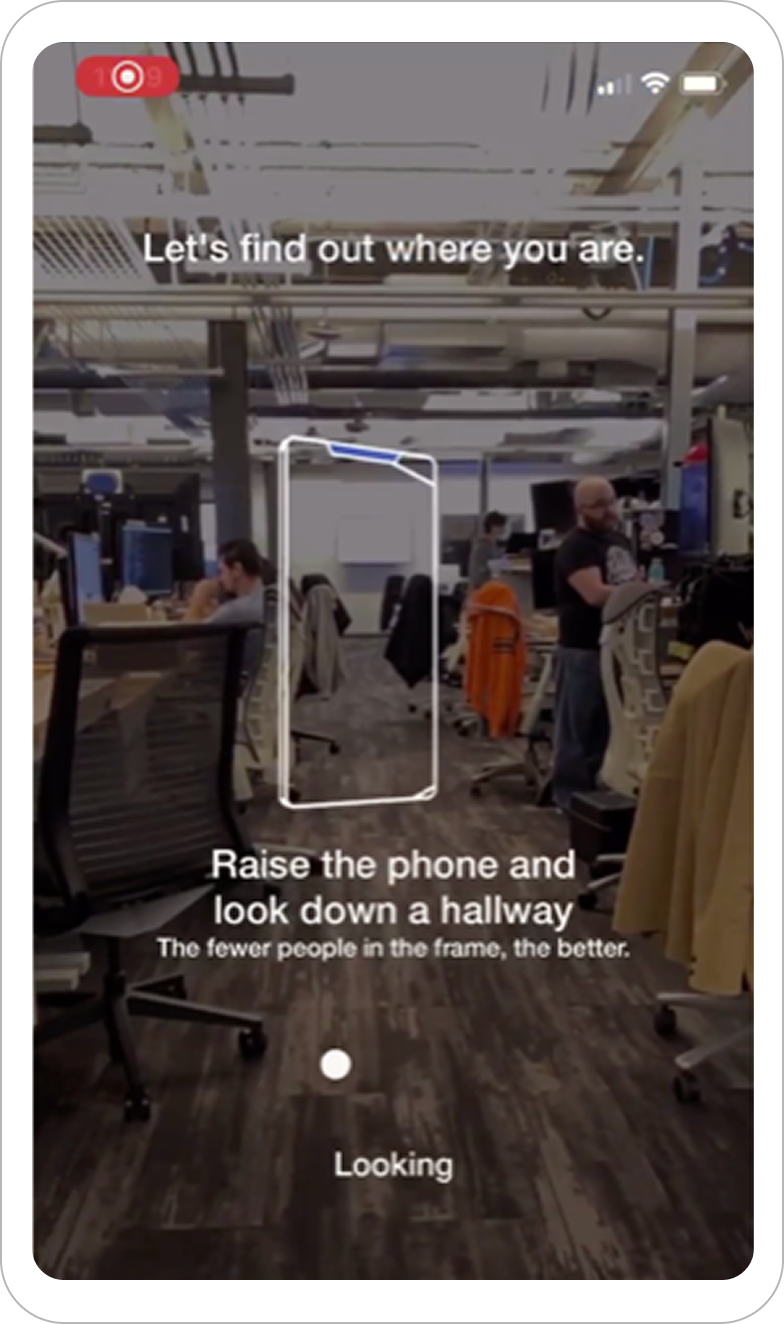
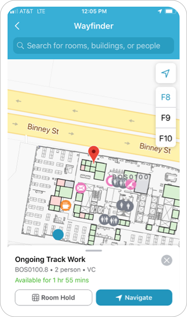
I designed an internal tool with the World.AI engineering team that we called Wayfinder. It utilized the wifi's mesh network alongside image recognition to locate the user. Once located, the app would guide the user to their desired destination while they held up their camera.
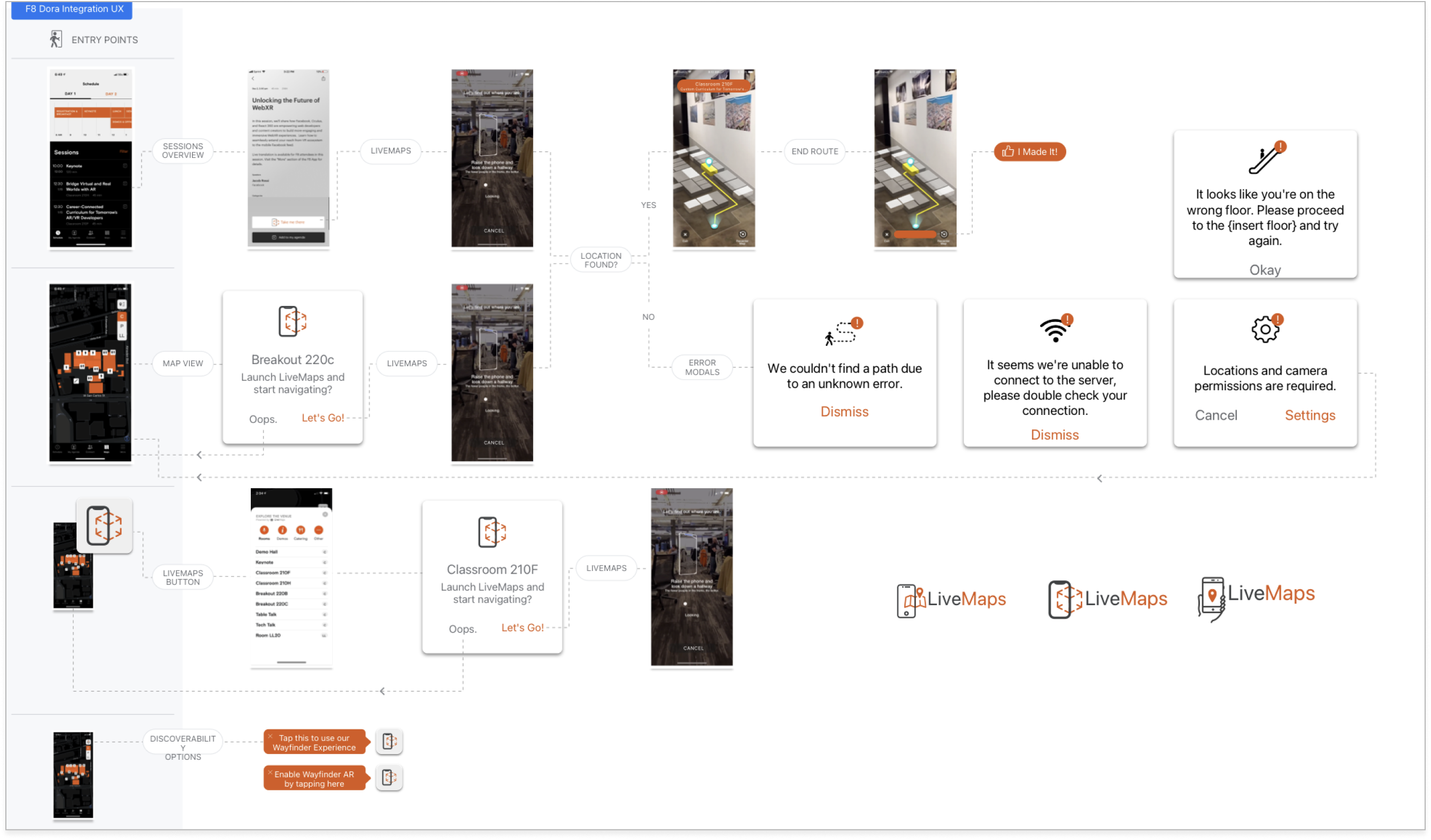
LiveMaps F8 Conference App
After several months of internal testing with Wayfinder, we were tasked with creating a public-facing version of the app for Facebook’s annual F8 event. Rebranded as LiveMaps, the app enabled conference attendees to receive live, turn-by-turn guidance to talks, sessions, and events throughout the venue.